


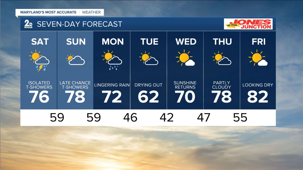
BALTIMORE — We get more active heading into the weekend. Showers and thundershowers are possible Saturday with some active returning Sunday evening. If you have weekend plans outside, don't cancel. There will be some dry time. Just keep the rain gear nearby just in case you get caught under one of these showers. A few could produce some localized heavy rain, a flash of lightning, and a rumble of thunder. Temps will be a bit cooler with numbers landing in the mid to upper 70s. We will cool down more next week. Some rain will be left over for Monday as well. Highs in the 60s expected for Tuesday as we dry out. Warmer weather is back to end next week. 80s are within reach once again.
7 Day Forecast:
Tonight A chance of showers. Mostly cloudy, with a low around 61. South wind 6 to 10 mph.
Saturday Showers likely and possibly a thunderstorm. Mostly cloudy, with a high near 76. Southeast wind around 6 mph. New rainfall amounts between a tenth and quarter of an inch, except higher amounts possible in thunderstorms.
Saturday Night A chance of showers and thunderstorms before 2am. Mostly cloudy, with a low around 59. Southeast wind around 5 mph becoming calm in the evening.
Sunday A slight chance of showers after 2pm. Partly sunny, with a high near 78.
Sunday Night Showers, mainly between 8pm and 2am. Low around 59.
Monday Showers likely, mainly before 8am. Partly cloudy, with a high near 72.
Monday Night Partly cloudy, with a low around 46.
Tuesday Partly cloudy, with a high near 64. Breezy.
Tuesday Night Mostly clear, with a low around 42.
Wednesday Mostly sunny, with a high near 70.
Wednesday Night Mostly clear, with a low around 47.
Thursday Partly cloudy, with a high near 78.
Thursday Night Partly cloudy, with a low around 55.
Friday Mostly sunny, with a high near 82.
