

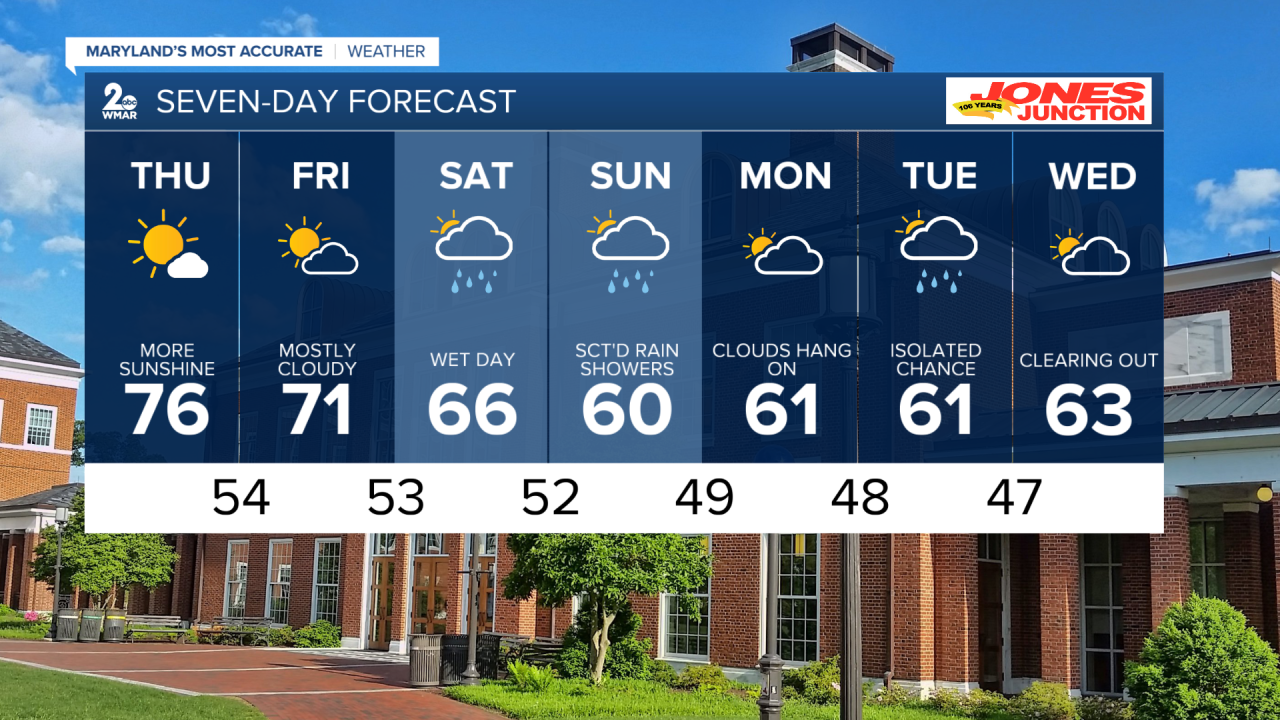
BALTIMORE — High pressure continues over into Thursday. Tomorrow will be the warmest day out of the next seven days, as highs hit the mid-70s. A low-pressure system moves in from the Ohio Valley this weekend- bringing widespread rain and gusty winds to central Maryland. The heaviest rain arrives Saturday evening into early Sunday. Temperatures trend cooler, in the 60s. Cooler temps return and clouds stick around. An additional rain chance is possible for Tuesday.
7 Day Forecast:
Tonight Partly cloudy, with a low around 49. Light southwest wind.
Thursday Mostly sunny to partly cloudy, with a high near 76.
Thursday Night Mostly clear, with a low around 54.
Friday Partly cloudy, with a high near 71.
Friday Night Mostly cloudy, with a low around 53.
Saturday Showers and possibly a thunderstorm after 2pm. High near 66.
Saturday Night Showers likely and possibly a thunderstorm. Mostly cloudy, with a low around 52.
Sunday A chance of showers. Mostly cloudy, with a high near 60.
Sunday Night Mostly cloudy, with a low around 49.
Monday Partly sunny, with a high near 61.
Monday Night Mostly cloudy, with a low around 48.
Tuesday A chance of showers. Mostly cloudy, with a high near 61.
Monday Night Mostly cloudy, with a low around 47.
Tuesday Partly sunny, with a high near 63.
