

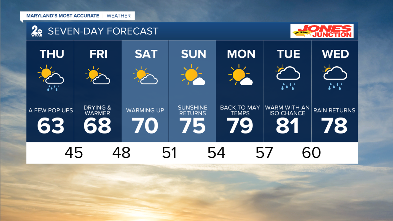
BALTIMORE — Showers are back for one more day this week as a low pressure continues to spin to our north. Thursday does look mostly dry, just not completely rain free. That changes by the end of the week and the weekend. With the dry skies comes a slight warm-up, at first. Our temperatures jump back into the upper 60for Friday and the 70s for the weekend! Sunday looks like the pick day of the two. Next week we warm a bit more. Making a run at 80, I think we fall just short Monday, but can get there on Tuesday. Showers return by the middle part of next week.
7 Day Forecast:
Tonight Showers and thunderstorms likely before midnight, then a slight chance of showers between midnight and 3am. Mostly cloudy, with a low around 42. New precipitation amounts of less than a tenth of an inch, except higher amounts possible in thunderstorms.
Thursday A chance of showers after 3pm. Partly sunny, with a high near 63. Northwest wind 8 to 11 mph.
Thursday Night A chance of showers before 9pm. Partly cloudy, with a low around 45. Northwest wind 5 to 7 mph.
Friday A slight chance of showers after 3pm. Mostly sunny, with a high near 68.
Friday Night Mostly cloudy, with a low around 48.
Saturday Partly cloudy, with a high near 70.
Saturday Night Partly cloudy, with a low around 51.
Sunday Mostly sunny, with a high near 75.
Sunday Night Partly cloudy, with a low around 54.
Monday Mostly sunny, with a high near 79.
Monday Night Partly cloudy, with a low around 56.
Tuesday A chance of showers. Mostly sunny, with a high near 81.
Tuesday Night Partly cloudy, with a low around 60.
Wednesday A chance of showers. Mostly sunny, with a high near 78.
