

BALTIMORE — We see a shift over the next few days with sunshine and temperatures back in the mid 60s and low 70s. Thursday will be our brightest and warmest day of the week. Another wet weather maker moves in on Friday as rain showers and cooler air returns. Next week so far looks dry with cooler temps.
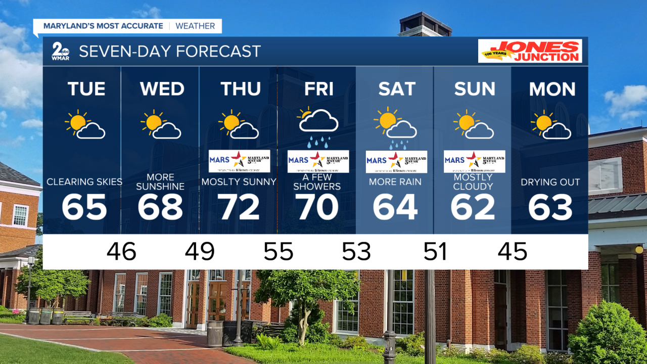
7 day forecast
Monday Night Mostly cloudy, with a low around 46. Northwest wind around 6 mph.
Tuesday Partly sunny, with a high near 65. Northwest wind 5 to 9 mph.
Tuesday Night Partly cloudy, with a low around 49. Calm wind.
Wednesday Sunny, with a high near 68.
Wednesday Night Mostly clear, with a low around 49.
Thursday Mostly sunny, with a high near 71.
Thursday Night Mostly cloudy, with a low around 55.
Friday A chance of showers after 8am. Mostly cloudy, with a high near 70.
Friday Night Showers likely. Mostly cloudy, with a low around 53.
Saturday A chance of showers. Partly sunny, with a high near 64.
Saturday Night Partly cloudy, with a low around 51.
Sunday Mostly sunny, with a high near 62. Breezy.
Sunday Night Partly cloudy, with a low around 45.
Monday Mostly sunny, with a high near 63. Breezy.
