


BALTIMORE — High pressure hangs around in for a short amount of time on Friday before our third system swings through this weekend. Cloud cover filters in throughout the day Friday and highs are shunned into the upper 50s. Rain showers arrive Saturday into the evening, with an additional 0.50-1" of rain expected. Flooding concerns are low after all of the past rain we've seen this week, but it's something to keep our eyes on. Temperatures will drop into the mid-50s this weekend with northwest winds increasing. A sunny and gusty start to next week with lots of sunshine. Temperatures climb back into the mid-60s by the middle of next week. Pollen levels will also increase as skies stay dry.

7 Day Forecast:
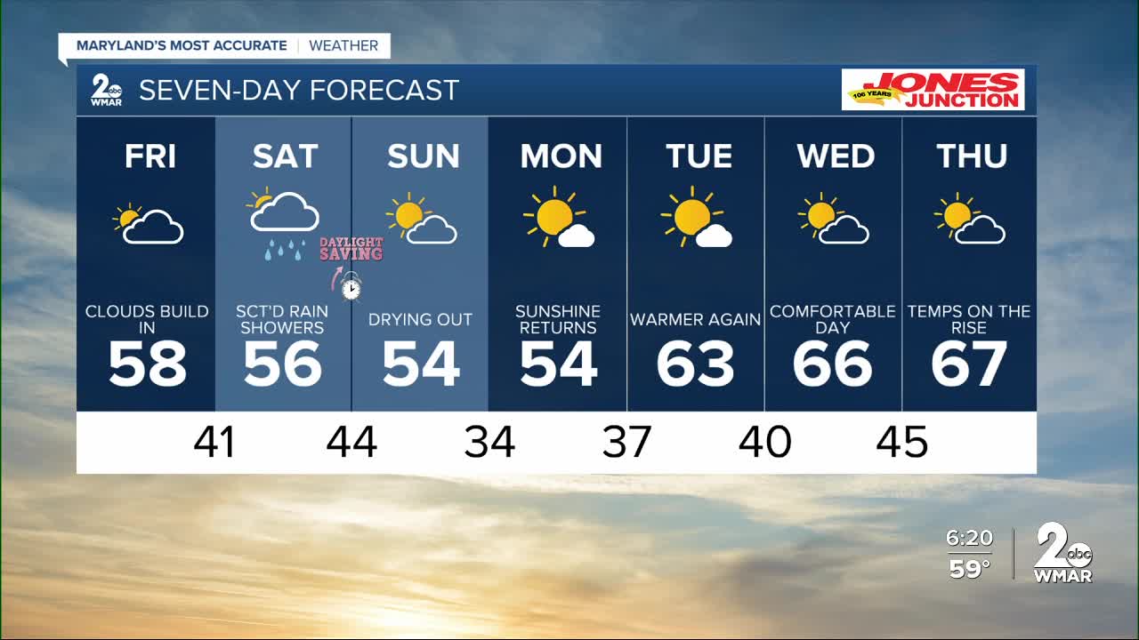
Tonight Partly cloudy, with a low around 40. North wind 5-10 mph.
Friday Increasing clouds, with a high near 58.
Friday Night A slight chance of rain. Cloudy, with a low around 41.
Saturday Rain likely. High near 56.
Saturday Night Showers. Low around 44. Breezy.
Sunday A chance of showers early. Partly cloudy, with a high near 54. Breezy.
Sunday Night Partly cloudy, with a low around 34. Breezy.
Monday Sunny, with a high near 54. Breezy.
Monday Night Clear, with a low around 37. Breezy.
Tuesday Sunny, with a high near 63.
Tuesday Night Mostly clear, with a low around 40.
Wednesday Partly cloudy, with a high near 65.
Wednesday Night Mostly clear, with a low around 45.
Thursday Partly cloudy, with a high near 67.

