

BALTIMORE — Happy Friday!
Calm and mostly cloudy this evening, with lows in the 40s range. Things remain cloudy and a little cool turning towards Saturday. High temperatures will rise into the low-60s! Warming up near 70° on Saturday and Sunday with an uptick in the humidity. This will help prime the environment for strong storm activity. A cold front brings a round of storms on Sunday afternoon and evening. Damaging winds and large hail will be the main threats. Skies dry out for St. Patrick's Day with milder temperatures through the middle of the week. The chance for showers increases on the first day of spring.
Have a sunny day!

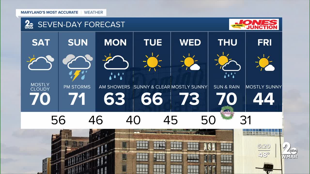
7 Day Forecast:
Today Cloudy through mid morning, then gradual clearing, with a high near 61. East wind 5-10 mph.
Tonight Patchy drizzle. Patchy fog. Otherwise, increasing clouds, with a low around 43. Southeast wind around 5-10 mph.
Saturday A slight chance of showers. Patchy fog. Otherwise, cloudy, with a high near 70.
Saturday Night A slight chance of showers. Mostly cloudy, with a low around 56.
Sunday Showers. High near 71. Breezy.
Sunday Night Showers. Low around 46.
Monday A chance of showers. Mostly sunny, with a high near 63.
Monday Night Mostly clear, with a low around 40.
Tuesday Sunny, with a high near 66.
Tuesday Night Mostly clear, with a low around 45.
Wednesday Mostly sunny, with a high near 73.
Wednesday Night Mostly cloudy, with a low around 50.
Thursday A chance of showers. Partly sunny, with a high near 70.
Thursday Night Showers likely. Partly cloudy, with a low around 31.
Friday Mostly sunny, with a high near 44.
