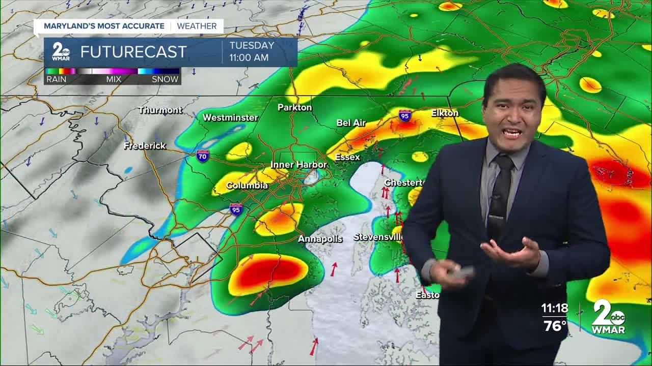


BALTIMORE — Showers and storms continue this afternoon and will become more numerous in nature this evening and into Tuesday morning. Temperatures will hold steady in the low 70s and upper 60s for our lows. Shower chances linger into Tuesday afternoon. It looks like the steadier/heavier rain will be focused across our northwest suburbs. Rainfall totals could be over an inch in areas north and west of the beltway. Rainfall totals will be lower southeast of the metro. Localized flooding is possible. A few isolated showers are possible on Wednesday before the weather pattern dries out late-week.
Stay Tuned!

7 Day Forecast:
Tonight Showers and possibly a thunderstorm. Patchy fog after 11pm. Low around 71. South wind 5 to 7 mph. Chance of precipitation is 90%. New rainfall amounts between a half and three quarters of an inch possible.
Tuesday Showers, with thunderstorms also possible after 11am. High near 82. Light and variable wind becoming northeast 5 to 8 mph in the morning. Chance of precipitation is 90%. New rainfall amounts between a half and three quarters of an inch possible.
Tuesday Night A chance of showers and thunderstorms. Mostly cloudy, with a low around 68. Northeast wind around 6 mph. Chance of precipitation is 40%.
Wednesday A chance of showers. Mostly cloudy, with a high near 78. Northeast wind 7 to 10 mph. Chance of precipitation is 40%.
Wednesday Night A slight chance of showers before 2am. Mostly cloudy, with a low around 64. Chance of precipitation is 20%.
Thursday Partly sunny, with a high near 81.
Thursday Night Mostly clear, with a low around 62.
Friday Sunny, with a high near 84.
Friday Night Mostly clear, with a low around 63.
Saturday Mostly sunny, with a high near 85.
Saturday Night Partly cloudy, with a low around 65.
Sunday Partly sunny, with a high near 86.
Sunday Night Mostly cloudy, with a low around 67.
Monday A chance of showers. Partly sunny, with a high near 84.
