


BALTIMORE — Happy Monday! There is a chance of showers developing later this afternoon and throughout the evening as an area of low pressure impacts the region. Temperatures will rise to seasonal levels, in the upper-60s with breezy southeast wind gusts about 25-30 mph at times. Drier skies and warmer temperatures on Tuesday, with highs in the low-80s. Warm with more sunshine mid-week, before temperatures slightly drop into the mid-70s on Friday. A cold front swings through on Saturday and sparks widespread rain across the area with highs in the mid-70s. Drier skies on Sunday with cooler temperatures, in the upper-60s.
Have a sunny day!
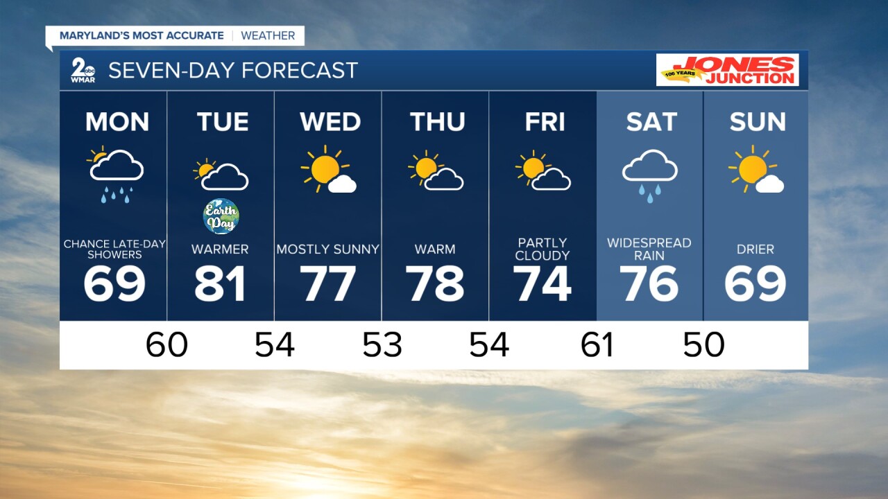
7 Day Forecast:
Today A slight chance of showers. Mostly cloudy, with a high near 69. Southeast wind 5-15 mph, with gusts as high as 25-30 mph.
Tonight A chance of showers. Mostly cloudy, with a low around 60. Southeast wind 5-10 mph becoming calm after midnight.
Tuesday Partly sunny, with a high near 81.
Tuesday Night Mostly cloudy, with a low around 54.
Wednesday Mostly sunny, with a high near 77.
Wednesday Night Mostly clear, with a low around 53.
Thursday Mostly sunny, with a high near 78.
Thursday Night Mostly cloudy, with a low around 54.
Friday A chance of showers. Mostly cloudy, with a high near 74.
Friday Night Showers likely and possibly a thunderstorm. Mostly cloudy, with a low around 61.
Saturday Showers likely. Mostly cloudy, with a high near 76.
Saturday Night A chance of showers. Partly cloudy, with a low around 50.
Sunday Sunny, with a high near 69.
