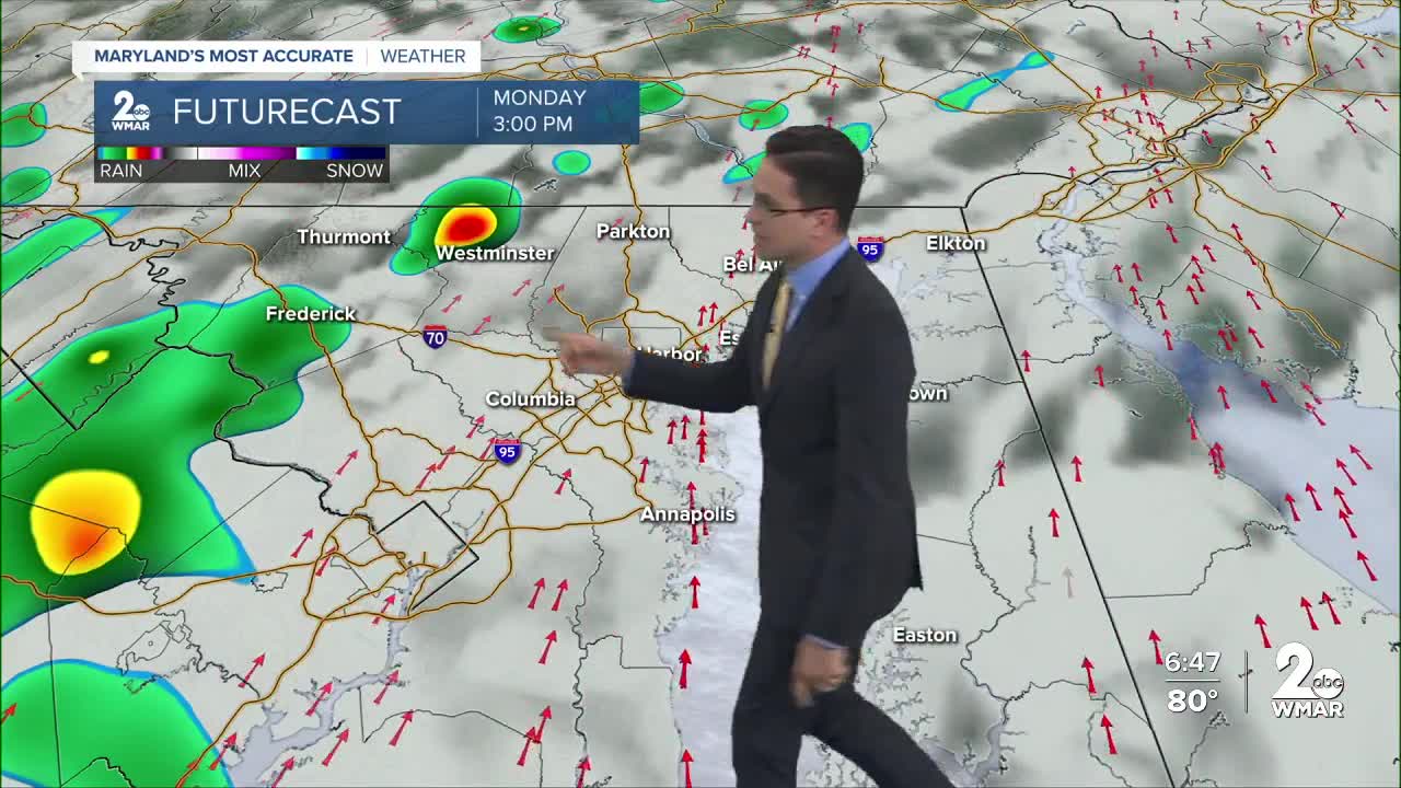


BALTIMORE — Storms and showers are back to start the week. Some could even be strong to severe. Our area is under a slight risk for severe weather, which is a level 2/5 from the Storm Prediction Center. Scattered showers and storms are possible in the morning. By the afternoon a few isolated to scattered storms will be around. A more organized line is expected by the early evening hours. Damaging wind is the main concern, but some hail, and an isolated tornado can't be ruled out. Have a way to get alerts! Skies clear out after that and we cool into the low 60s for Tuesday and Wednesday. Temperatures jump again by the end of the week with showers back Friday. Another cold front keeps us cooler this weekend.

Tonight Mostly cloudy, with a low around 64. South wind 8 to 10 mph, with gusts as high as 20 mph.
Monday Isolated showers, then showers and thunderstorms after 2pm. High near 80. South wind 11 to 15 mph, with gusts as high as 26 mph.
Monday Night Showers and thunderstorms before 8pm, then showers and possibly a thunderstorm between 8pm and 2am, then a slight chance of showers after 2am. Low around 46.
Tuesday Sunny, with a high near 61. Northwest wind 11 to 13 mph, with gusts as high as 21 mph.
Tuesday Night Mostly clear, with a low around 42. Northeast wind 3 to 5 mph.
Wednesday Partly sunny, with a high near 61.
Wednesday Night Mostly cloudy, with a low around 54.
Thursday A chance of showers after 2pm. Mostly cloudy, with a high near 81.
Thursday Night A chance of showers. Mostly cloudy, with a low around 64.
Friday A chance of showers. Cloudy, with a high near 77.
Friday Night A chance of showers. Mostly cloudy, with a low around 51.
Saturday Showers likely. Mostly cloudy, with a high near 62.
Saturday Night A chance of showers. Mostly cloudy, with a low around 46.
Sunday A chance of showers. Mostly cloudy, with a high near 62.
