

BALTIMORE — High pressure dominates the weather pattern through mid-week- keeping skies dry with plenty of sunshine and above normal temperatures, in the low-80s. Afternoon temperatures later this week will trend slightly cooler, in the upper-70s thanks to more clouds building into the region. A cold front will bring the chance for showers Friday afternoon into Saturday. It will feel more like Fall behind the cold front on Saturday with highs in the low-70s. Temperatures will drop below normal on Sunday, into the mid-60s with drier conditions.
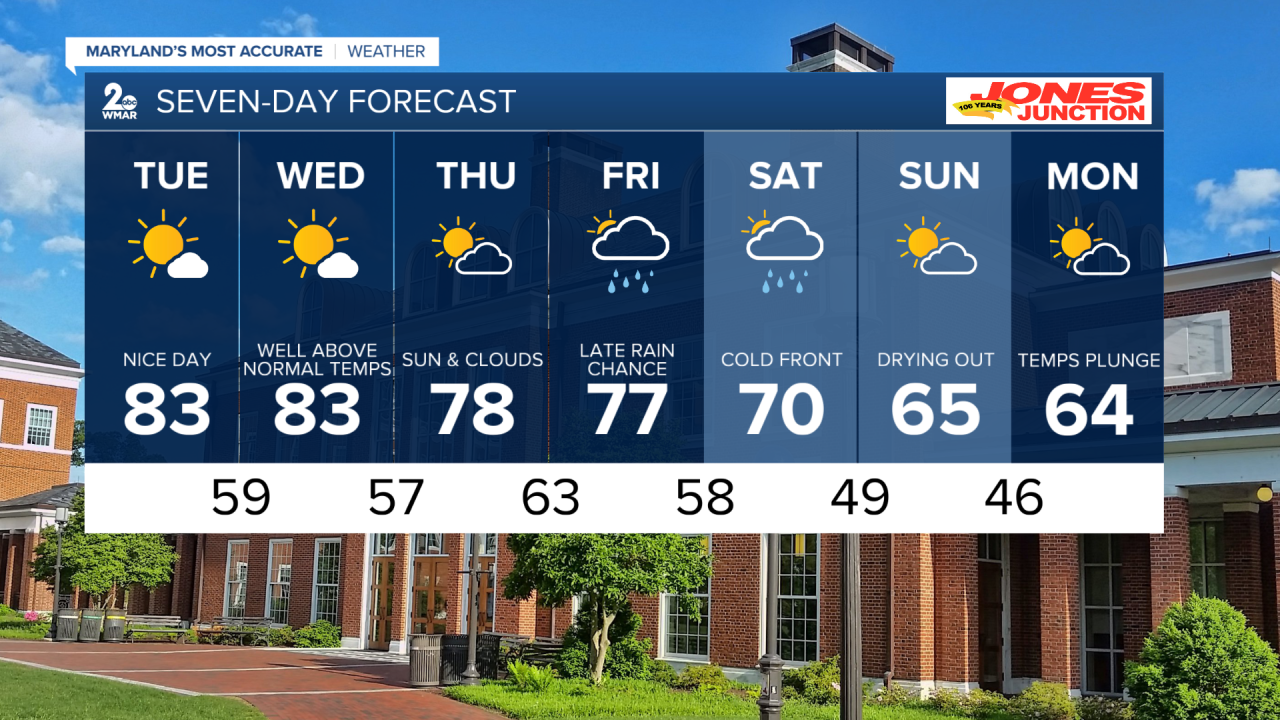
7 Day Forecast:
Tonight Partly cloudy, with a low around 59. Calm wind.
Tuesday Mostly sunny, with a high near 83.
Tuesday Night Mostly clear, with a low around 59.
Wednesday Patchy fog before 10am. Otherwise, sunny, with a high near 83.
Wednesday Night Mostly clear, with a low around 57.
Thursday Mostly sunny, with a high near 78.
Thursday Night Mostly cloudy, with a low around 63.
Friday A chance of showers after 2pm. Mostly cloudy, with a high near 77.
Friday Night Showers likely. Mostly cloudy, with a low around 58.
Saturday A chance of showers. Partly sunny, with a high near 70.
Saturday Night Mostly clear, with a low around 49.
Sunday Mostly sunny, with a high near 65.
Sunday Night Mostly clear, with a low around 46.
Monday Mostly sunny, with a high near 64.
