

BALTIMORE — The heat is on! Temperatures will get well above average over the next few days. In some cases we will see readings 20° above average for this time of year. Skies stay sunny. We will struggle to even get a cloud overhead the next few days let alone any rain. We will be close to a record, but likely fall just short. It is rare air none the less! Showers and storms are back for this weekend. Saturday looks like scattered rain at this point. There will be some dry time, but be ready to bring it inside for a bit. A good portion of Sunday is dry. We will watch for a line of storms to move in by the late afternoon. Some rain is back early next week, but most look to stay dry.
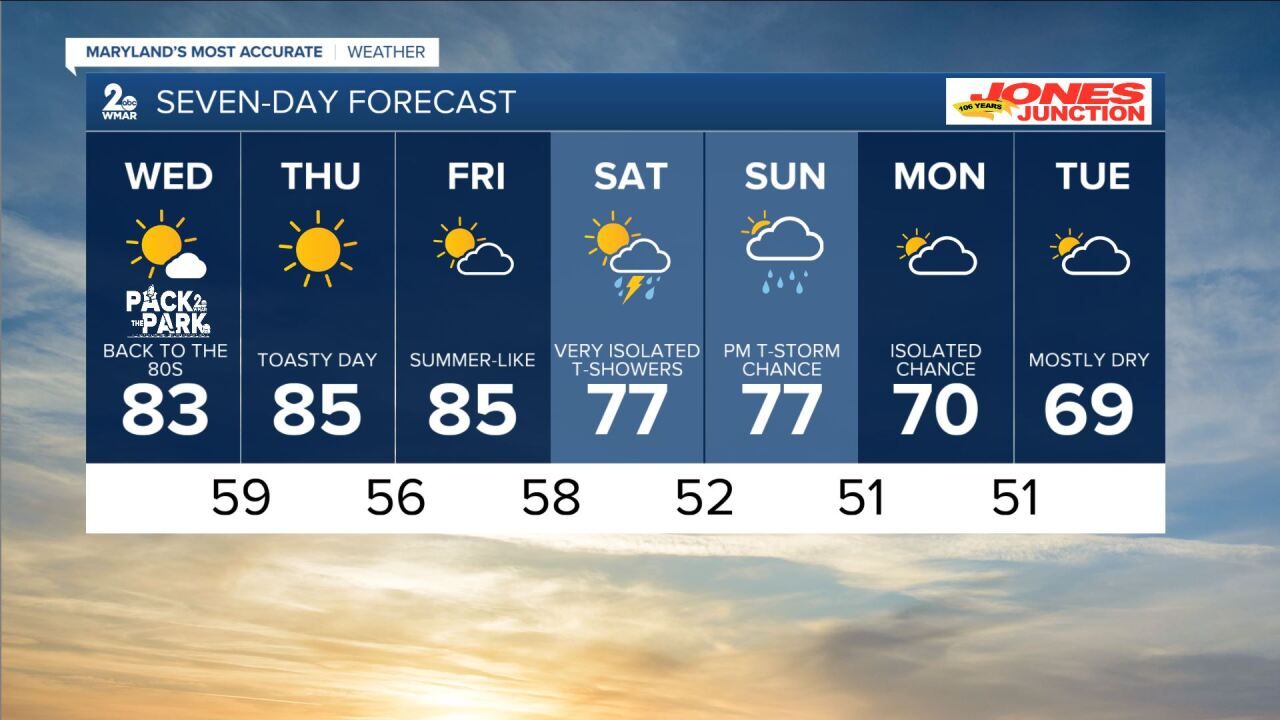
7 Day Forecast:
Tonight Partly cloudy, with a low around 55. West wind 7 to 9 mph.
Wednesday Mostly sunny, with a high near 83. West wind 9 to 15 mph, with gusts as high as 22 mph.
Wednesday Night Mostly clear, with a low around 59. West wind around 8 mph.
Thursday Sunny, with a high near 85.
Thursday Night Mostly clear, with a low around 56.
Friday Mostly sunny, with a high near 85.
Friday Night A chance of showers after 2am. Mostly cloudy, with a low around 61.
Saturday A chance of showers and isolated thunderstorms. Partly cloudy, with a high near 78.
Saturday Night Partly cloudy, with a low around 59.
Sunday A chance of showers and thunderstorms. Partly sunny, with a high near 77.
Sunday Night A chance of showers. Partly cloudy, with a low around 51.
Monday Partly cloudy, with a high near 70.
Monday Night Partly cloudy, with a low around 51.
Tuesday Mostly sunny, with a high near 70.
