


The remnants of Debby will impact Maryland tonight through Friday night. Even though it is projected to weaken to a tropical depression, do not let your guard down! The Storm Prediction Center has placed the bulk of the area under a Marginal Risk for Friday, as gusty winds and flooding will be top concerns.

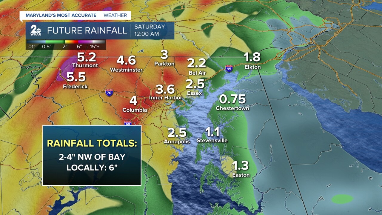
Average rainfall totals between 2-4" is expected with locally higher amounts to the northwest of the Chesapeake Bay.
The placement of Debby will be a problem for central Maryland because the core of this tropical system will be just to our west. It looks likely that Baltimore will be placed on the eastern side of the storm, which means more instability and wind shear present. This will create more spin in the atmosphere as winds remain strong in the upper levels and slower near the surface. This is where we could see some isolated tornadoes (usually weak and short-lived but will still pose a major threat to life and property).

#StevieDanielsWX #Debby
Email: stevie.daniels@wmar.com
Facebook: www.facebook.com/StevieDanielsWX
X: www.twitter.com/StevieDanielsWX
Instagram & TikTok: stevie_daniels_

