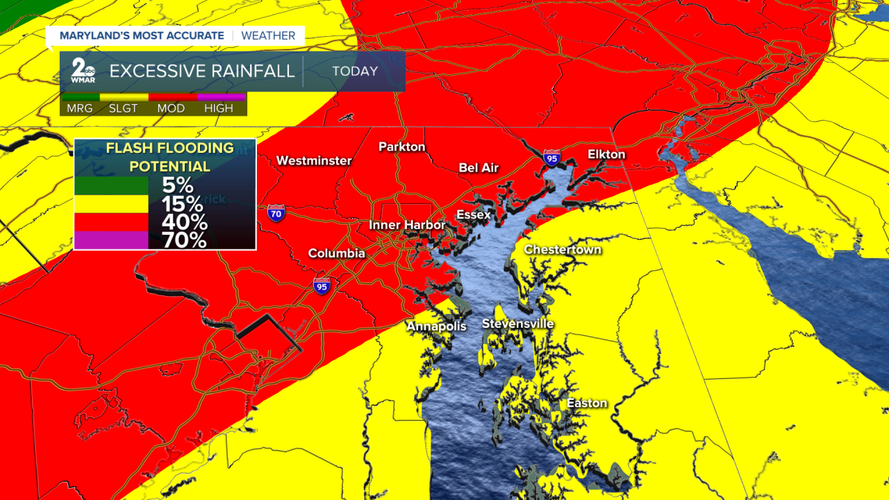


Rain overspreads the area by mid to late-morning and persists through the rest of the day. Rainfall totals between 1-3" are possible, with locally higher amounts of 4"+. This will lead to widespread flooding across the area. Streams and rivers will likely reach their flood stage and become swollen. There are still concerns for flash flooding along/near the I-95 corridor. The Weather Prediction Center has areas northwest of the bay under a moderate risk for flash flooding (40%).

Wind Advisories will be in place starting at 3 PM for our northwestern suburbs and areas along the Eastern Shore as wind gusts between 50-55 mph can be expected. High Wind Warnings will go into effect at 3 PM the western bayshore as winds may gust up to 60 mph at times. The strongest wind gusts will be along and east of I-95 which could lead to sporadic tree damage, resulting in widespread power outages. Now is the time to secure outdoor furniture and trash cans! It's also a good excuse to take down those Christmas/holiday decorations.

The strong southerly winds, high tides, and elevated river levels will help push the bay water along the immediate shorelines- leading to significant coastal flooding. Coastal Flood Warnings go into effect this afternoon through Wednesday morning for the Eastern shore and until Wednesday evening for the western bayshore, as tides will be running anywhere from 4-6 feet above normal.

Here is a look at today's afternoon and evening high tides:

#StevieDanielsWX #Flooding #StrongWinds
Email: stevie.daniels@wmar.com
Facebook: www.facebook.com/StevieDanielsWX
X: www.twitter.com/StevieDanielsWX
Instagram & TikTok: stevie_daniels_

