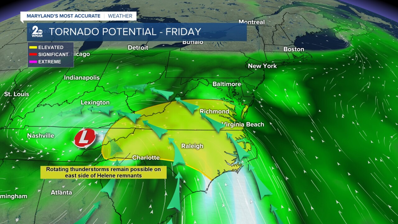
Helene is a category 1 hurricane, but will rapidly intensify today as it travels through the warm Gulf waters. It is expected to make landfall tonight somewhere along the Bid Bend of Florida as a large major hurricane! Catastrophic wind damage and deadly life-threatening storm surge is likely along the coast. Some locations could see up to 20 feet of storm surge! Flooding and strong winds will even be felt away from the center, farther inland across the southeast portion of the country on today and Friday.

Helene will track northwest through the Tennessee River Valley on Friday and Saturday. The better chance flooding, strong wind gusts, and tornadoes will be to the southwest of Maryland on the eastern side of the tropical moisture. The remnants of Helene will get absorbed by a cutoff low (an area of low pressure upstairs in the atmosphere that gets displaced from the normal westerly current). This moisture will then travel eastward, bringing steady widespread rain to Maryland on Friday and lingering on/off rain showers through the weekend. Overall, the rain will be largely beneficial as it will help out with drought concerns.

Moderate coastal flooding is possible along the west side of the bay on Friday into Saturday as winds shift more southeasterly. A Coastal Flood Watch goes into effect this evening for the Anne Arundel county shoreline as tidal flooding is possible around low-lying locations. Right now, average rainfall totals of 0.25-1" can be expected through Saturday morning. Locally higher amounts are not out of the question. Any changes to the future track of Helene will cause these numbers to fluctuate.

Stick with Maryland's Most Accurate Weather team for all the latest updates regarding the track of Helene!
#StevieDanielsWX
Email: stevie.daniels@wmar.com
Facebook: www.facebook.com/StevieDanielsWX
X: www.twitter.com/StevieDanielsWX
Instagram & TikTok: stevie_daniels_


