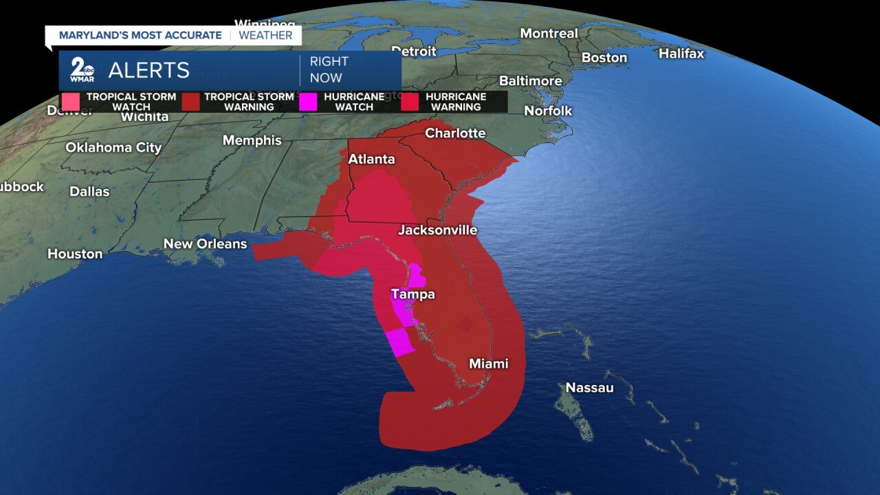
BALTIMORE — Once again, the tropics are heating up, and as of the 11 AM update on 9/24/2024, the National Hurricane Center has upgraded Potential Tropical Cyclone Nine into Tropical Storm Helene. As of the 11 AM update on 9/25/2024, Helene has officially become a hurricane. Helene looks to become a major hurricane in the next few hours due to rapid intensification. As of the 5 PM update on 9/25/2024, Helene continues to be a strong category one storm.

Helene currently has maximum sustained winds of 50 mph as the storm moves northwest. Spaghetti models currently have Nine heading into the gulf and towards the Big Bend of Florida. The NHC is now expecting the storm to reach category four strength with winds up to 130 mph. Some areas could see up to 20+ feet of storm surge.


The storm will encounter very warm near 90-degree gulf waters and is expected to become a major hurricane as it moves closer to Florida. This storm looks to be large, therefore, the cone covers a large surface area. Tropical storm and hurricane watches and warnings are up across Florida.

Helene is the ninth named storm and is now the fifth hurricane of the 2024 Atlantic Hurricane Season. Maryland could see some of the remnants of this storm over the weekend, but things could change. Right now steering mechanisms keep us dry.

Other than Helene, there are now two tropical waves to keep an eye on. One is currently off the coast of Africa with a medium chance of development over the next two days and a high chance over the next seven days. The other wave is in the North Atlantic heading out to sea with a low development chance. Both waves are not expected to impact Maryland.


