


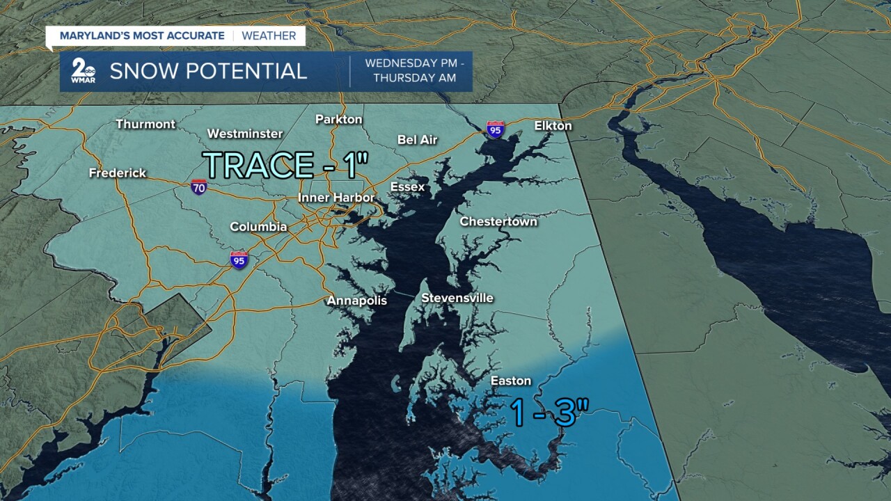
I think snow lovers in the Baltimore area will be disappointed with the snowfall potential mid-week. Light snow will develop Wednesday afternoon and will linger into Thursday morning. There has been a significant drop in expected snowfall totals across central Maryland. The latest model runs still have the center of the system placed farther south, which ultimately suppresses snowfall amounts for us. The European model and the American GFS model have the heavier snow moving through Virginia and southern Maryland. Winter Storm Watches go into effect for southern Maryland, the lower end of the Eastern shore, and along the coastline as 3-6" of snow is possible. This will create slippery roads, which could impact the Wednesday evening and Thursday morning commutes.

Overall, a coating-1" of snow is expected through Thursday morning when it's all said and done. There is more dry air in place near the state line, so totals will be lower across our northern suburbs. We will continue to keep an eye on this system because even a slight shift in the storm track north or south, will dictate how much snow we see. We will likely need to adjust this map if we see the storm wobbling. Placement is key!
#StevieDanielsWX
Email: stevie.daniels@wmar.com
Facebook: www.facebook.com/StevieDanielsWX
X: www.twitter.com/StevieDanielsWX
Instagram & TikTok: stevie_daniels_
