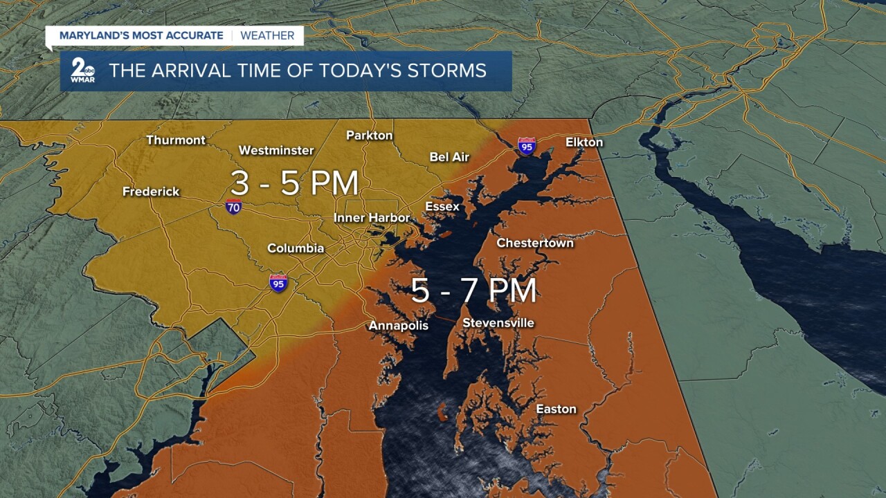
BALTIMORE — The thunderstorm threat is conditional, which means that any storms that form could become severe later today. The atmosphere is already primed with warmth and moisture ahead of the cold front. If we happen to see some breaks in the clouds before the showers and storms arrive, this will add fuel to what is already an unstable atmosphere.

If everything comes together and the storms don't fizzle out from traveling over the mountains, we should see them bubble up later this afternoon. Showers and storms will likely hit our northwest communities first before spreading eastward into northeast Maryland and over the Eastern Shore by 6-7 pm. The storm threat lingers a few hours after sun goes down, given all the warmth and moisture present. The window for strong to severe storms will open between 4-10 pm.

While this system has had a history of producing flash flooding and long-tracked tornadoes across the Midwest, the major concerns for central Maryland will be damaging wind gusts and large-sized hail up to about 1" in diameter. This is the size of a quarter, which is actually considered severe!

The tornado threat is going to be on the lower end of the scale, but it is not zero! The Storm Prediction Center has expanded the Slight Risk (level 2/5) slightly southward and now is in place for all of northeast Maryland.

There will be plenty of shear in the environment, and CAPE (Convective Available Potential Energy) values will be high, indicating that there should be enough fuel and energy present for thunderstorms to tap into. This will promote the development of strong thunderstorm updrafts! There will also be a decent amount of wind shear in the atmosphere (change in wind speed and wind direction with height). This is a key ingredient for the formation of supercells and tornadoes.

Make sure you are weather aware and ready before severe weather strikes. Don't let it catch you off guard!

#StevieDanielsWX #SevereWeather
Email: stevie.daniels@wmar.com
Facebook: www.facebook.com/StevieDanielsWX
X: www.twitter.com/StevieDanielsWX
Instagram & TikTok: stevie_daniels_


