What does this winter season have in store? Will we see a lot of snow or no snow? I think the answer lies somewhere in between....you know, the baby bear forecast.
This winter season, December-February, is once again forecast to be much like the previous winter season.
A weak La Niña will influence this winter, but it won’t overtake the weather pattern. La Niña is the cooling of the Eastern and Central Tropical Pacific Ocean. It’s the opposite of El Niño, which is the warming of the Eastern and Central Tropical Pacific Ocean.


Although La Niña is caused by the relationship between the Pacific Ocean and the atmosphere above, its reach is wide and long because it affects the weather all around the world.
La Niña is one of the reasons we will enter a second consecutive winter season with a forecast for above normal temperatures and below/near normal snowfall.
During winter, weather in the Arctic and in the mid latitudes go hand in hand as the atmospheric pressure ebbs and flows between negative and positive at the polar and mid latitudes.
When the Arctic Oscillation or AO is in the negative phase, cold Arctic air masses dive into the Midwest and Eastern U.S. and the number of storms rise. When the AO is in the positive phase, colder air and storms are locked up across the polar region.
The North Atlantic Oscillation or NAO is sometimes interchangeable with the AO except the NAO keeps its eye on two main changes in the atmosphere over the North Atlantic….a low close to Iceland and a high close to the Azores Islands.
A negative NAO means that there is just a little pressure difference between the low and the high, which like the AO, indicates cold conditions and an uptick in storms.

A positive NAO means there is a large pressure difference between the low and the high, which like the positive AO leads to warmer temperatures in the Eastern U.S.

The AO and NAO will be mainly neutral. Mainly is the key word because there may be changes in the NAO, mostly, in February.
October snow cover in Siberia is not to be overlooked because that trend tends to favor more snow in the Mid Atlantic, especially if there is snow cover with blocking. If there is a cold system and there is no blocking, the snow will quickly change over to a wintry mix/rain. A blocking pattern blocks the warm air so the cold air and snow "stick" around longer (pun intended).
Also, the Polar Vortex may be awakened and that will prompt the cold air from the north to dip south. Hence, colder temperatures and snow.

Last season had more snow, at 10.9", than the year before with a measly 1.8”. This year, I believe, will be closer to last year give or take a few inches either way.

New climate data from 1991-2020 for December, January and February shows the average snowfall for BWI is 19.3.

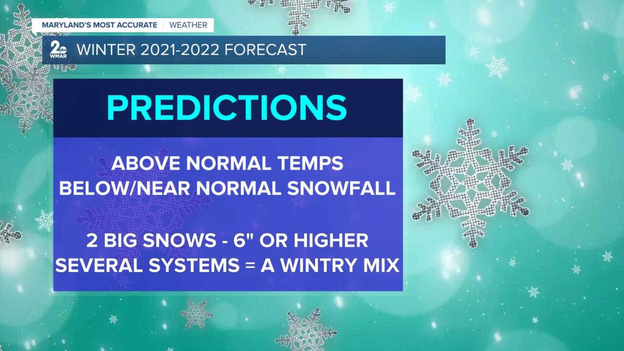
With that said, my forecast for the 2021-2022 season, in a nutshell, is temperatures will be above normal and snowfall will be below or near normal. I'm predicting 2 big snows, 6 inches or higher. Most of the snow will fall late January and February. There will be several systems that will move in December through February, but much of the precipitation will be a wintry mix. Therefore, cutting down on snow totals. Temperatures will be below normal as winter comes to an end.

This forecast is not bad for, both, snow lovers and for those who aren't keen on snow.
Stay tuned!
#staytuned
@LynetteWMAR
https://www.facebook.com/Lynetteweather


