


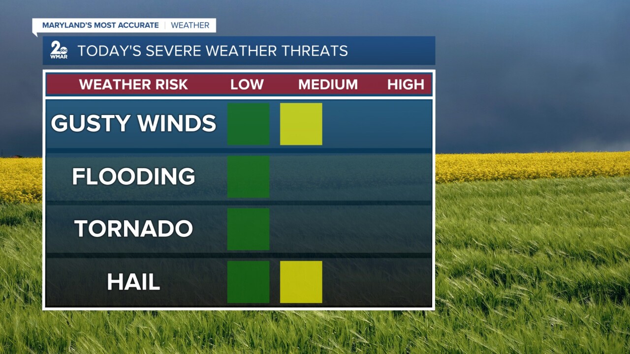
Another day, another chance of isolated strong to severe storms! The Storm Prediction Center has placed areas in green under a Marginal Risk (level 1/5). The heat and humidity will help prime the environment for storm development this afternoon/evening. Today, the severe storm threat will be focused in areas near and to the west of the bay. Numerous showers and scattered thunderstorms will arrive around mid-afternoon as a warm front lifts to our north, and a cold front approaches from the west.

For the most part, these thunderstorms should be limited in intensity/duration, but any stronger storms that form could produce damaging wind gusts and large-sized hail. Periods of heavy rainfall are possible, leading to the chance for isolated instances of flooding. The tornado threat is low but not zero, it depends on any subtle changes in the cloud cover throughout the day. More sunshine/heating = more instability for thunderstorms.
Make sure you and your family are familiar with your severe weather safety plan in case severe weather strikes!
#StevieDanielsWX #Storms
Email: stevie.daniels@wmar.com
Facebook: www.facebook.com/StevieDanielsWX
X: www.twitter.com/StevieDanielsWX
Instagram & TikTok: stevie_daniels_
