


BALTIMORE — Good Sunday evening everyone! The fog continues across the state as cooler temperature stick around. The good news is that the fog should start filter out by midnight. Drying out on Monday with temperatures back in the 50s. Temperatures cool down through the middle of next week with highs only warming into the 40s. We are watching Wednesday's system very closely as computer models keep flip-flopping back and forth with the potential for wintry precipitation. It looks like a very small chance now early Wednesday morning. Winds continue to gust into Thursday as we stay dry into the weekend.
I hope you all have a great week!
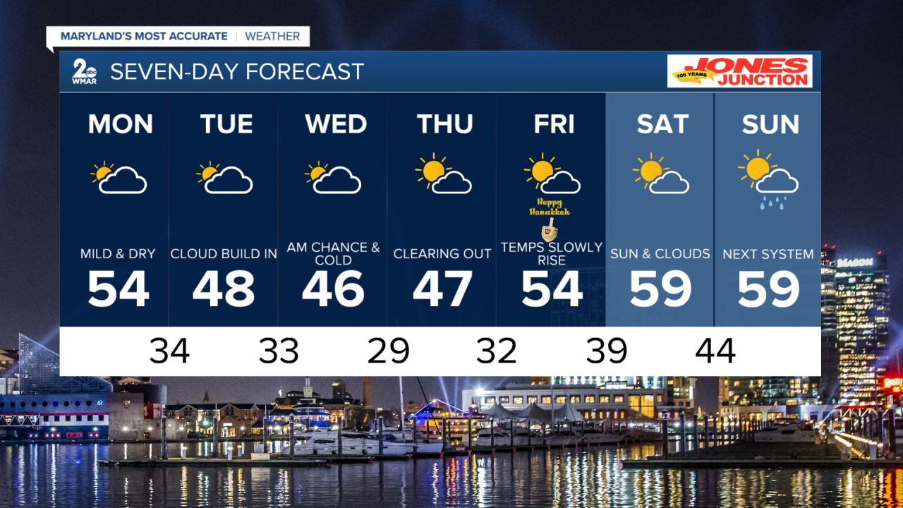
7 Day Forecast:
Tonight Patchy fog before 10pm. Otherwise, cloudy during the early evening, then gradual clearing, with a low around 40. West wind 6 to 10 mph.
Monday Partly sunny, with a high near 54. West wind 8 to 10 mph.
Monday Night Mostly clear, with a low around 34. West wind around 9 mph.
Tuesday Partly sunny, with a high near 48. West wind 6 to 8 mph.
Tuesday Night A chance of showers, mainly after 1am. Mostly cloudy, with a low around 33. North wind 3 to 5 mph.
Wednesday Partly sunny, with a high near 46.
Wednesday Night Mostly clear, with a low around 29.
Thursday Partly sunny, with a high near 46.
Thursday Night Partly cloudy, with a low around 32.
Friday Mostly sunny, with a high near 54.
Friday Night Partly cloudy, with a low around 39.
Saturday Mostly sunny, with a high near 59.
Saturday Night Partly cloudy, with a low around 44.
Sunday A chance of showers. Partly sunny, with a high near 59.
